
Map of Kashaya territory
This map shows the Kashaya tribal territory as defined by Robert Oswalt in his 1961 dissertation, based especially on the linguistic origins of local placenames.
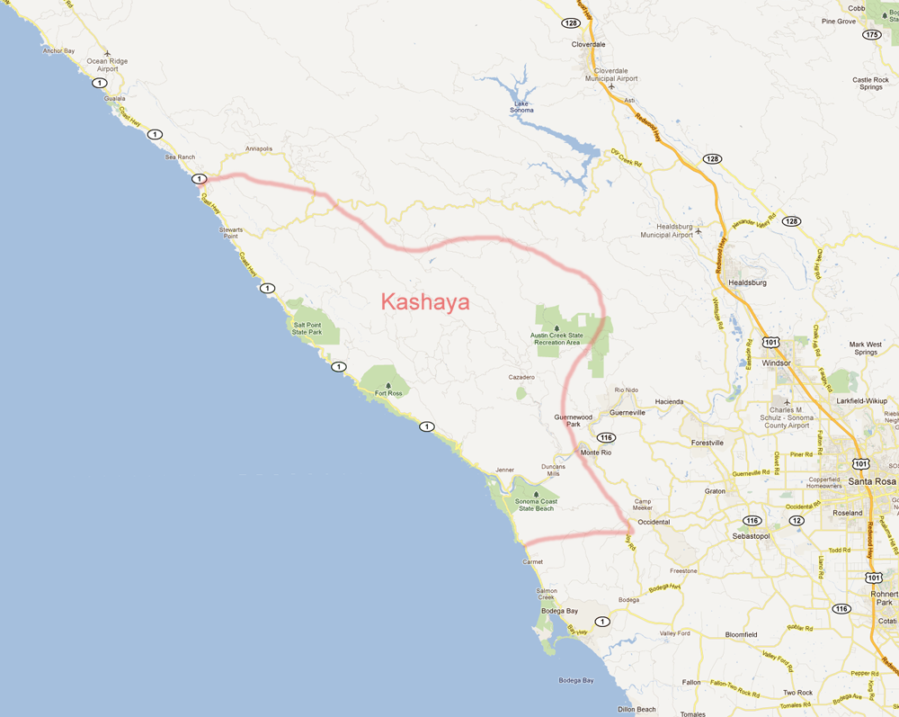
Some other sources place the upper boundary further north at Gualala (rather than Black Point, as on this map), and the lower boundary also further north at the Russian River (rather than Salmon Creek).
Kashaya Dictionary © 2018 Robert Oswalt®